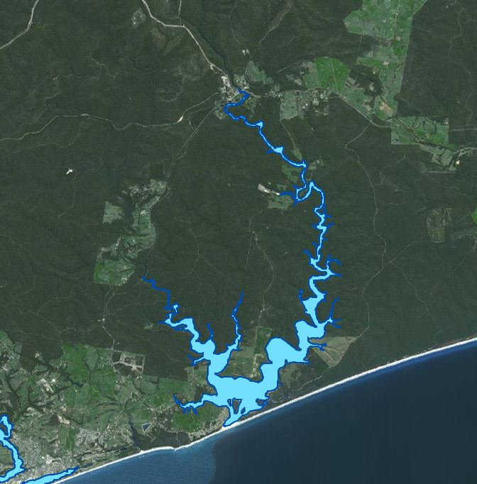
Lakes Tyers
About the Waterway
Lake Tyers is located on the south coast of Victoria, east of Lakes Entrance, approximately 350 kms (4 hours travel time) by road from the Melbourne CBD, accessed by the Princes Highway via the major tourist town of Lakes Entrance.
Lake Tyers is a small waterway which is generally closed to Bass Strait, although on occasions is opened by prevailing weather and water levels or assisted by man. The lake is a popular tourist destination for holiday makers and anglers alike. Most of the Lakes and extending arms are navigable by recreational vessels.

Navigational Information
VOZR (Vessel Operating and Zoning Rules) Schedule 105 Lake Tyers
Go to NTM’s (for this waterway)
Navigational aids within the Gippsland Regional Ports conform to the International Association of Lighthouse Authorities (IALA) Buoyage System “A”. Starboard-hand (or right side) marks are green, whilst Port-Hand (or left side) marks are red. Cardinal marks are yellow and black; Special marks are yellow and Isolated Danger marks black and red.
In using the system it is essential to remember that the direction of buoyage is taken from the seaward entrance of these ports. When returning towards the entrance the situation would be reversed.
Go to Waterways Online
Go to bathymetric surveys
Boating Facilities
Waterway users and yachtsmen are cautioned about the existence of overhead electric cables across Lake Tyers and should keep on the look out for warning notices on the shore and riverbanks advising of the following obstructions and safety heights.
OVERHEAD CABLES
Cautionary Note: Power Line Clearance levels for Lake Tyers have been supplied by SP Ausnet and are based on clearances above Australian Height Datum (mean sea level). Heights may vary in certain weather conditions (e.g. loss of clearance height during floods or when the ocean entrance is closed.)
FACILITIES MANAGED BY GIPPSLAND PORTS:
All navigation aids and zoning signs/buoys
FACILITIES MANAGED BY OTHER AUTHORITIES:
East Gippsland Shire Council
- Lakes Tyers Mill Point Launching Area
- Lakes Tyers – Nowa Nowa Floating Landing
- Lakes Tyers Fishermans Landing Jetty
- Lakes Tyers – Nowa Nowa Boat Ramp Jetty
- Lake Tyers No 2 Boat Ramp and Jetty

