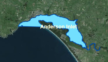
Anderson Inlet
About the Port
The Port of Anderson Inlet is located on the south coast of Victoria, west of Wilsons Promontory, approximately 140kms (2 hours travel time) by road from the Melbourne CBD, accessed via the small South Gippsland town of Inverloch.
Anderson Inlet lies at the head of Venus Bay, extending from its entrance to Bass Strait approximately 11 kms to Tarwin River at its head. The Port provides good recreational boating areas, however, the Inlet is tidal and at times the locations in which vessels can operate are restricted due to water depths.

Navigational Information
Relevant Chart AUS 801
VOZR (Vessel Operating and Zoning Rules) Schedule 114 Local Port of Anderson Inlet
CAUTIONS
Local knowledge is required to cross the entrance of the bar, due to varying depths, shifting shoals, strong tidal currents and dangerous sea states. There are strong currents at the entrance and severe sea conditions exist on the shallow bar outside the entrance. Click Here For more information on Crossing Bars.
Vessel operators are advised to carry a copy of the tide tables when operating in these waterways and to seek local knowledge if unsure of the tidal flow. There are draught restrictions at Anderson Inlet depending on the condition of the bar and the state of the tide.
If intending to go boating in the Inlet, mariners should seek local advice as to the location of sandbars and mud banks.
CHANNELS IN THE PORT OF ANDERSON INLET
Anderson Inlet Channel
Due to the dynamic nature of Anderson Inlet channel depths, its course, and the location of navigation buoys are subject to change.
Venus Bay Boat Ramp Channel
A shallow channel that can only be navigated by shallow draught, suitably designed vessels during favourable tide conditions. The seabed in the channel and adjacent areas consist of very fine silt.
Tarwin River
Due to shoaling, access to the river is restricted to shallow draught vessels, at times of high tide.
Go to Waterways Online
Go to Bathymetry Surveys
Boating Facilities
FACILITIES MANAGED BY GIPPSLAND PORTS:
All navigation aids and zoning signs/buoys
Inverloch Boat Ramp Jetty and tide board
Tarwin Lower Boat Ramp Jetty
A limited swing mooring zone is located east of Inverloch Jetty.
FACILITIES MANAGED BY OTHER AUTHORITIES:
Bass Coast Shire
Inverloch Boat Ramp
Mahers Landing Boat Ramp
Tarwin Lower Boat Ramp
Venus Bay Boat Ramp

