Navigation Information
There are general State rules that apply to all waterways in Victoria, supplemented by local scheduled operating and zoning rules for specific waterways.
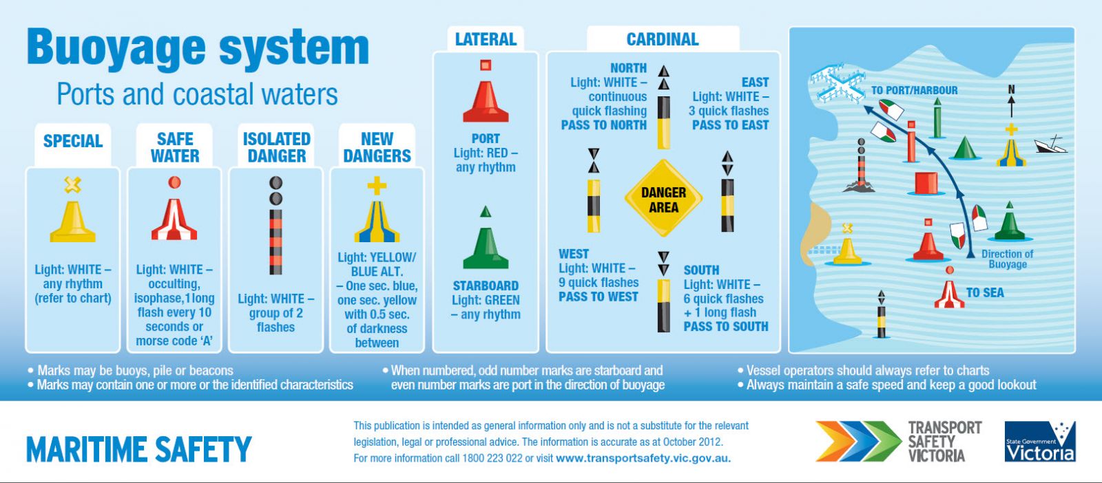
Navigational aids within the Gippsland Regional Ports conform to the International Association of Lighthouse Authorities (IALA) Buoyage System “A”. Starboard-hand marks are green, whilst port-hand marks are red. Cardinal marks are yellow and black; Special marks are yellow and isolated danger marks black and red. Safe Water marks are red and white. In using the system it is essential to remember that the direction of buoyage is taken from the seaward entrance of these ports. When returning towards the entrance the situation is reversed.
Voyage planning is an essential element in safe boating. Before hitting the water it pays to access local maps and charts in order to familiarise yourself with local navigation aids and to plan a safe route to your destination.

For reference to further information on buoyage and navigation rules and regulations that apply in Victoria refer to Transport Safety Victoria website.
Gippsland Ports’ Navigation Information
View the links below for information on cautions and local conditions at each of the ports and waterways under Gippsland Ports’ management.

